|
 |
|
|
|
|
|
|
|
|
|
|
||||||||
|
Crown Creek Ranch 203 Acres |
|||||||||||||||||||||||||||||||||||||||||||||||||||||||
Click on any picture below to view in a larger size. |
|||||||||||||||||||||||||||||||||||||||||||||||||||||||
|
|||||||||||||||||||||||||||||||||||||||||||||||||||||||
| Property Description
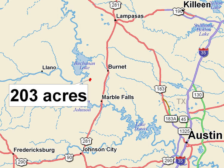
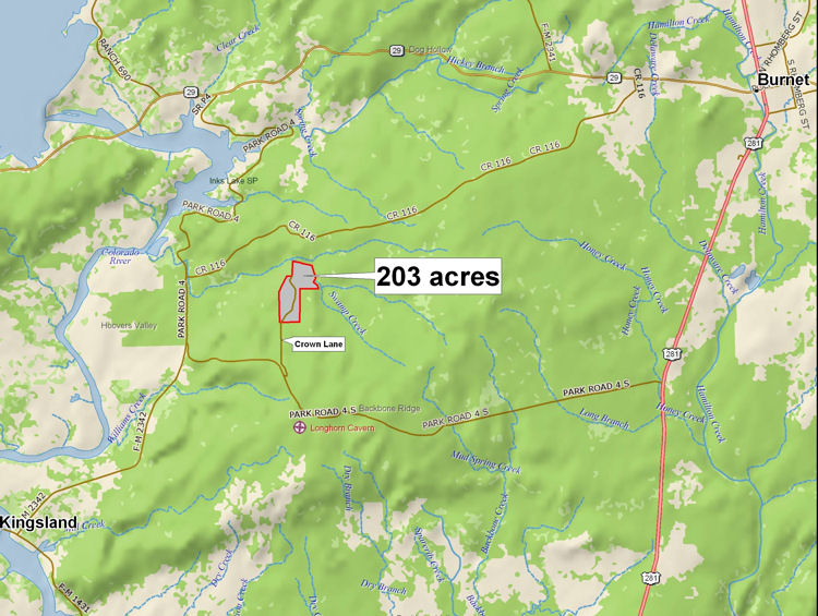
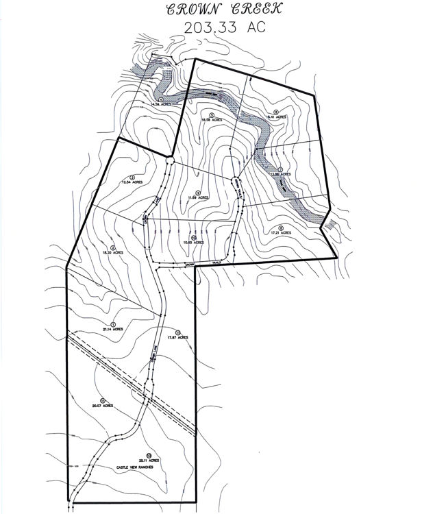
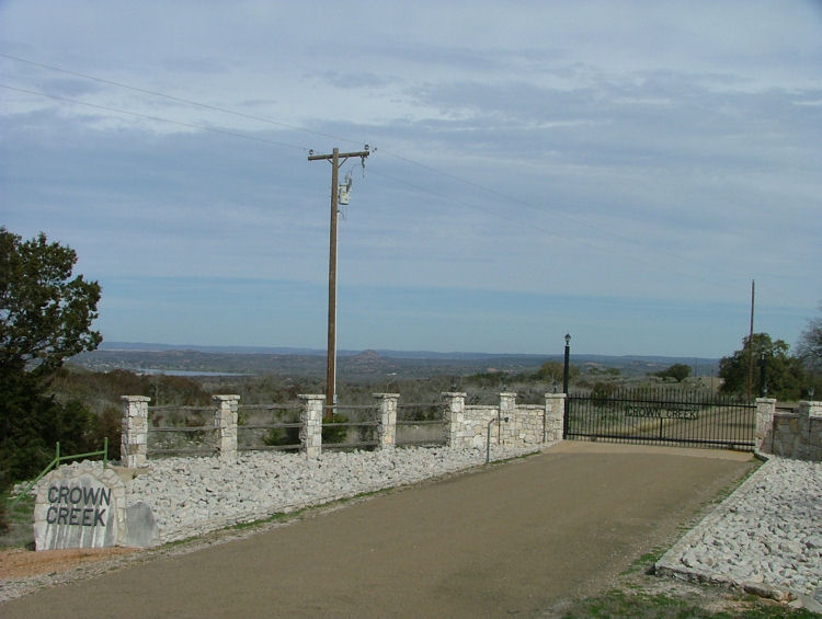
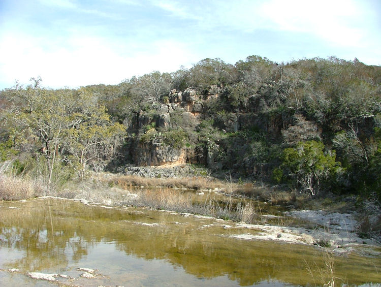
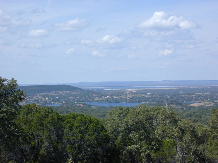
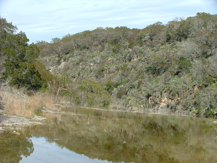
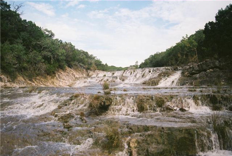
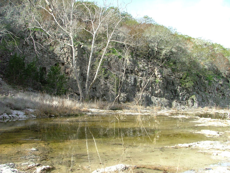
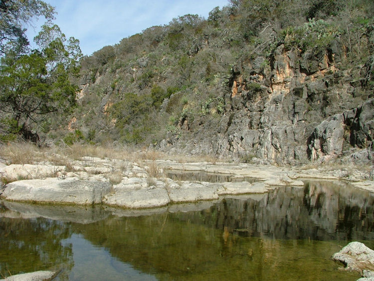
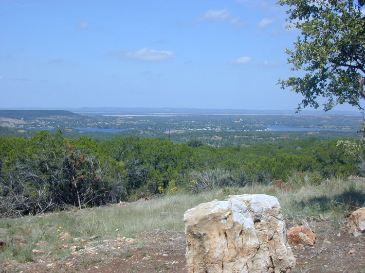
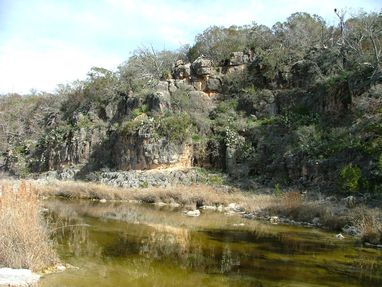
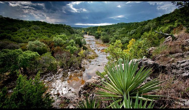
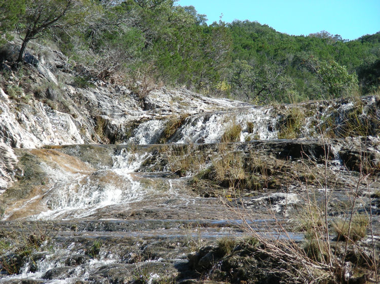
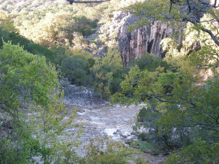
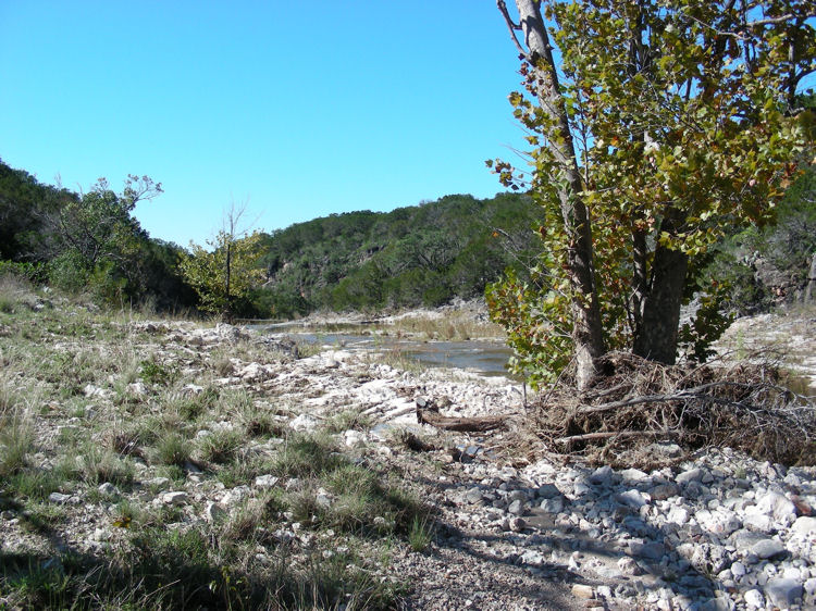
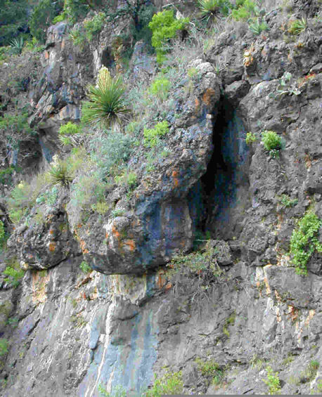
This 203 acre ranch features some of the most dramatic scenery in all the Hill Country. There are views of Inks Lake and Lake Buchanan from numerous sites all over the ranch. Additionally, one of the strongest spring-fed creeks in Burnet County carves through the ranch creating a canyon with over 100 foot high rock bluffs. The creek is one of the few in the Hill Country that was flowing during the summer of the 2011 drought. The solid rock bottom creek is wide with many impressive waterfalls along the half mile or so that flows through the property. The 203 acres consists of 12 platted lots in Crown Creek and Castle View Ranches. This unique situation provides a wonderful investment opportunity. The roads are built and the lots are ready to build on. Each lot affords incredible lake views or creek frontage -- or in some cases, both! The ranch is located on the highly desirable Park Road 4, across from Longhorn Cavern State Park, within 15 minutes or so of Burnet, Kingsland and Marble Falls. Property Summary SheetSIZE: 203 acres +/- consisting of 10 tracts in Crown Creek and two tracts in Castle View Ranches. Will divide into 88.4 acres, 69.75 acres, or 45.18 acres UTILITIES: Electric
WATER WELL: 2 wells, 225 ft – 30 GPM & 305 ft – 30 GPM (per well report) SURFACE WATER: Spring fed, year round, Peter’s Creek (about half a mile on both sides) TERRAIN: Very hilly with canyons, rock bluffs, views of Inks Lake and Lake Buchanan TREES: Oak, elm, cedar, sycamore and cottonwoods in the creek bottom WILDLIFE: Deer, turkey SCHOOL DISTRICT: Burnet MINERALS: Will convey all owned PROPERTY TAXES: Ag valuation / Wildlife exemptions, 2011 taxes were $279.94 (per appraisal district) RESTRICTIONS: Yes Price: $12,000 per acre |
|||||||||||||||||||||||||||||||||||||||||||||||||||||||
 |
|||||||||||||||||||||||||||||||||||||||||||||||||||||||
Interactive Map of Property To zoom in or out or to pan, use buttons inset at top left corner of map. To view satellite image or terrain map, use buttons inset at top right corner of map. |
|||||||||||||||||||||||||||||||||||||||||||||||||||||||
|
|||||||||||||||||||||||||||||||||||||||||||||||||||||||
|
|||||||||||||||||||||||||||||||||||||||||||||||||||||||
For more photos and information please contact:
Phone: 512-756-9230 |
|||||||||||||||||||||||||||||||||||||||||||||||||||||||
|
|||||||||||||||||||||||||||||||||||||||||||||||||||||||
*To view PDF files on your computer, you must have a PDF reader program installed. You can download a free PDF reader |
|||||||||||||||||||||||||||||||||||||||||||||||||||||||
|
|||||||||||||||||||||||||||||||||||||||||||||||||||||||